BIM Coordination
We provide BIM Coordination services:
We provide BIM Coordination services:
We provide Converting to CAD service:
We provide 3D Modeling and Infrastructure Visualization services:
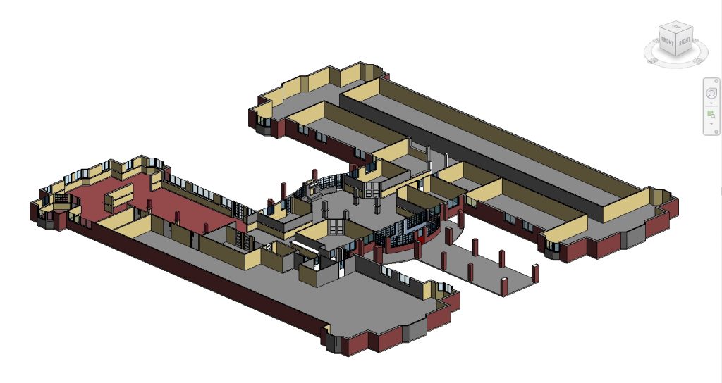
Project information: Architectural model of the current building in Autodesk Revit software. The model is used for the repair and renovation process. Input data are old design drawings, photos and videos of the current state of the building.

Project information: Substation modeling done in Autodesk Infraworks. The model shows the access road to the substation connected to the existing road, excavation area, fence… The landscape of trees is shown with the size and type according to the design. 3D models of substations, power poles… illustrated according to the actual situation.
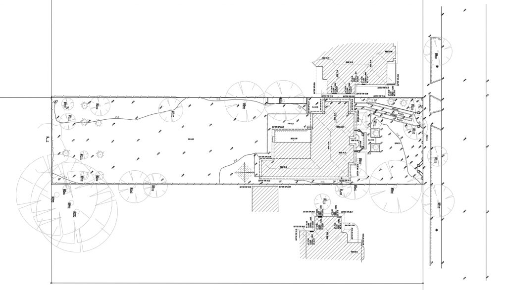
Project information: Create 2D drawings from point cloud, including drawings of Floor plans, Site plan. Display information about the size, height of windows, doors, ceilings, roofs… Display information about terrain elevation, contour lines and other objects such as trees, power poles,… The input data is a point cloud. Drawings are presented in accordance with regional/national…
Read more
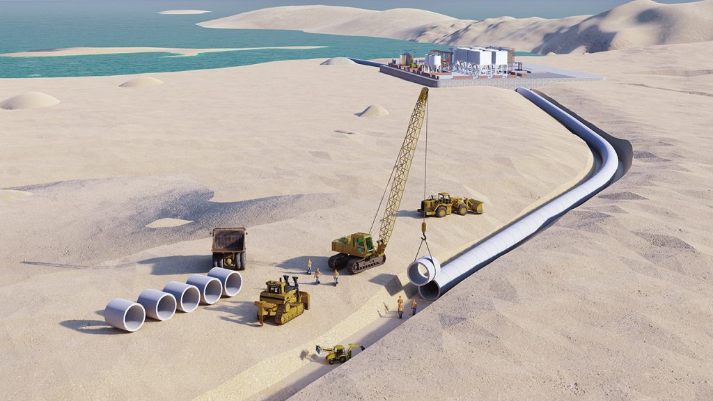
Project information: Create a 3D image illustrating the construction process of a seawater treatment plant. Illustrating the construction of a pipeline system connecting the plant to areas in the city.

Project information: Create as-built CAD drawings from Point cloud data CAD drawings not only follow the survey data (point cloud) but also show materials as well as surface conditions of walls, roof …
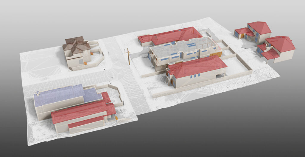
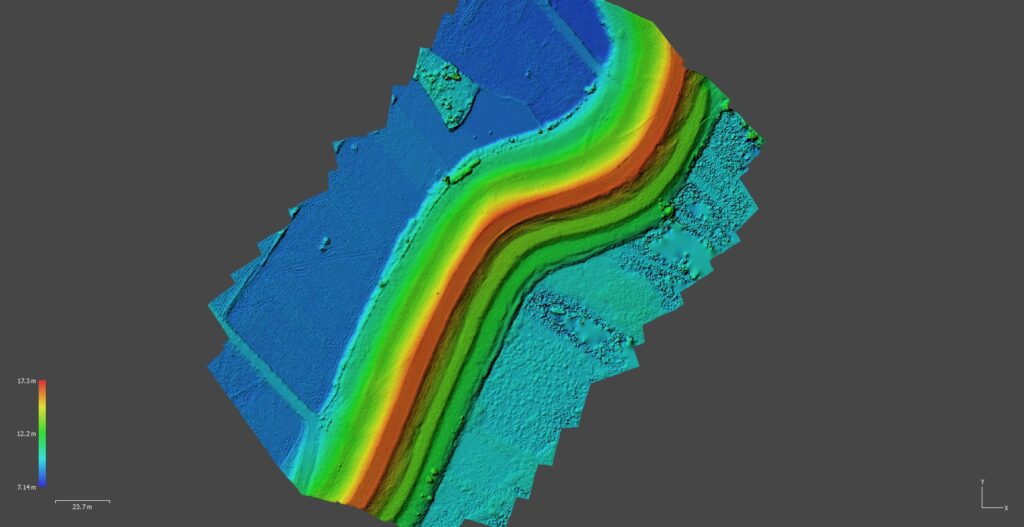
Project Information: Create 3D BIM models of Infrastructure: Road, Building, Signs, Electric Pole, Lighting Pole. Build contour, create 2D GIS survey drawings. Input data from Point cloud, Drone photos.
Project Information: Processing photos and videos taken from Drone, UAV survey or conventional imaging devices. The result is Point cloud, 3D mesh model, DEM (Terrain), Orthophotos.